
The American Southwest: A Region-Wide Guide for Road Trippers and Slow Travelers

Key Takeaways
Why the Southwest Works So Well for Road Trips
Few regions in the United States pack as much visual variety into drivable distances as the American Southwest. Within a single week you can move from slot canyons to pine-forested plateaus, from adobe villages to neon-lit desert cities — all connected by a road network that ranges from interstate efficiency to remote two-lane magic.
That drivability is the core appeal. Unlike destinations that require hopping between airports, the Southwest rewards patients and curious travelers who are willing to stay in the car a little longer, pull over at unnamed overlooks, and let detours become the story. Whether you're mapping a two-week circuit or committing to a slower, month-long immersion, slowing your pace in the Southwest tends to pay off significantly — towns that look like gas-stop blips on a map often turn out to be the most memorable stops.
If this is your first time building a trip of this scale, starting with a clear itinerary framework before you book anything will save real headaches later.
Build buffer days into any Southwest itinerary — ideally one rest or flex day for every three travel days. Distances look manageable on a map, but the scenery consistently tempts you to stop, and you'll want the freedom to say yes.
Southwest drives routinely take longer than GPS estimates suggest because pull-offs, wildlife crossings, and scenic detours are constant. Travelers who over-schedule consistently report the most regret.
Book your first and last nights of the trip in a city with airport access (Las Vegas, Phoenix, Albuquerque, Denver) so that flight delays don't cost you a night inside the parks.
Park-adjacent accommodation is scarce and expensive; keeping travel logistics at the city-gateway level protects the high-value nights for actual exploration.
Utah: Canyon Country and the Mighty 5
Utah is the anchor of any serious Southwest road trip. The state's five major national parks — Zion, Bryce Canyon, Capitol Reef, Canyonlands, and Arches — cluster close enough together that travelers can visit all five in roughly 10 days without feeling rushed. Each one offers something genuinely distinct: Zion's sheer sandstone walls and the iconic Narrows slot canyon; Bryce's surreal hoodoo amphitheaters; Capitol Reef's relatively uncrowded Waterpocket Fold; Canyonlands' sheer scale and solitude; and Arches' photogenic red-rock spans.
The single most important thing Utah visitors need to know is that timed-entry permits are now required at several parks, most prominently Zion and Arches during peak season. These sell out weeks or months in advance. Check the Recreation.gov and individual park websites well before your travel dates — do not assume walk-up access.
Permit Systems Change — Always Verify
Utah's national park permit requirements are updated seasonally and sometimes year to year. What was walk-up accessible one season may require a lottery permit the next. Check each park's official National Park Service page and Recreation.gov several months before your trip. Showing up without a required permit means turning around.
Beyond the Mighty 5, southern Utah's Grand Staircase-Escalante National Monument offers weeks of exploration for those who prefer backcountry solitude over crowds. The town of Moab serves as a logical base for Arches and Canyonlands and has a strong selection of outfitters for guided hikes, river floats, and mountain biking.
Arizona: Grand Vistas and Desert Culture
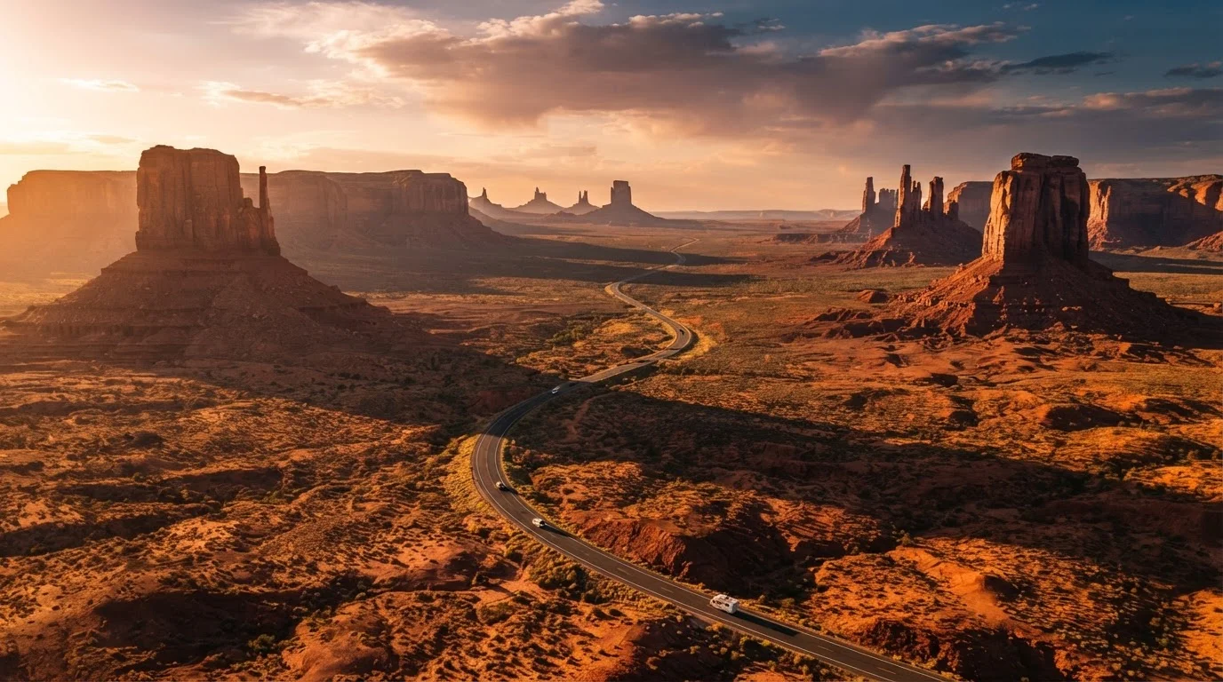
Arizona's crown jewel needs no introduction — the Grand Canyon's South Rim is one of the most visited natural sites on Earth — but the state offers far more depth than a single viewpoint. Sedona, roughly two hours south of the Canyon, trades the tourist intensity for a more laid-back vibe while still delivering striking red-rock scenery and a legitimate arts community. Monument Valley on the Utah-Arizona border provides one of the most iconic landscapes in American photography, though travelers should be aware that the area sits within the Navajo Nation and entry requires paying the tribal park fee.
Tucson is an underrated Southwest hub. It anchors access to Saguaro National Park (split into two districts flanking the city), the Arizona-Sonora Desert Museum, and the culinary scene that reflects the region's Mexican and Indigenous influences. Arizona's lower desert elevations — Phoenix, Tucson — can exceed 110°F in July and August. If you're traveling in summer, target higher-elevation destinations like Flagstaff (roughly 7,000 feet) or schedule desert activities strictly for early morning.
6+ million
Annual visitors to Grand Canyon South Rim
According to National Park Service visitation data, the Grand Canyon consistently ranks among the most visited national parks in the U.S.
134°F
Highest reliably recorded air temperature in Death Valley
Death Valley, accessible via Nevada on a Southwest circuit, holds the record for the highest reliably recorded air temperature on Earth.
~2,000 miles
Typical full Southwest circuit distance
A loop connecting Las Vegas, Utah's Mighty 5, Monument Valley, and Albuquerque covers roughly 2,000 driving miles depending on the specific route.
New Mexico: High Desert, History, and Art
New Mexico operates on a different frequency than the rest of the Southwest, and that's precisely its appeal. The state blends Indigenous Pueblo culture, Spanish colonial history, mid-century atomic-age history, and a contemporary art scene into something that feels unlike anywhere else in the country. Santa Fe, the state capital, is walkable, relatively compact, and genuinely absorbing — the Palace of the Governors on the plaza has been continuously occupied since 1610, making it the oldest public building in the U.S.
Taos, about 70 miles north, adds a bohemian creative energy and access to Taos Pueblo, a UNESCO World Heritage Site that has been continuously inhabited for over 1,000 years. Treat any visit to Taos Pueblo with the cultural seriousness it deserves — photography rules and access hours are regulated by the Pueblo community.
The Carlsbad Caverns in the state's southeastern corner offer a completely different kind of wonder: a vast underground cave system reachable by elevator or a steep walking trail. White Sands National Park, with its gypsum dune fields unlike anything else in the region, rounds out New Mexico's remarkable variety. For travelers who've previously focused on Utah and Arizona, New Mexico rewards a dedicated visit on its own terms.
Nevada and Colorado: Gateway Extremes
Nevada's contribution to a Southwest circuit is mostly Las Vegas as a practical gateway — flights, car rentals, and a convenient starting or ending point. But the state also holds Death Valley (shared with California), which is worth a careful approach. It's one of the hottest and driest places on Earth; visit only between October and April, carry far more water than you think you'll need, and check road conditions before entering.
Colorado adds a dramatically different elevation register. Mesa Verde National Park, in the state's southwestern corner, preserves some of the most remarkable cliff dwellings in North America — built by Ancestral Puebloans and abandoned by the late 13th century. The park is often grafted onto a Utah circuit via the Four Corners area, which also gives travelers an easy geographic reason to visit New Mexico and Arizona simultaneously. Durango serves as a functional base and has its own charm as a mountain town with a historic narrow-gauge railroad still running to Silverton.
Road trip logistics through this region involve long gaps between services on many routes — particularly in Nevada and Utah's backcountry. Fuel up more often than you think necessary.
Logistics Every Southwest Traveler Should Know
A few practical realities shape every Southwest trip regardless of which states you prioritize. Cell coverage is genuinely sparse across large stretches of Utah, Nevada, and eastern New Mexico. Download offline maps (apps like Maps.me or Google Maps offline) before leaving any city, and let someone know your general route if you're heading into remote areas.
Water is the non-negotiable. Dehydration and heat illness are real risks, particularly at low desert elevations in late spring through early fall. Carry at least one gallon of water per person per day when hiking; more if temperatures are extreme. National park visitor centers can advise on current conditions.
Accommodation in popular areas — Moab, Sedona, the Grand Canyon's South Rim — books out months in advance during spring and fall peak seasons. If you're building a trip from scratch, working through the full planning process early will meaningfully improve your options. Camping inside or near national parks requires reservations through Recreation.gov; free dispersed camping on Bureau of Land Management land is abundant but requires research to locate legally.
Finally, if your route dips toward the border, travelers curious about extending into Mexico should understand what land border crossings involve before making that part of the plan. Always verify current entry requirements with official U.S. and Mexican government sources before traveling.